What Is The Difficulty Level Of The Everest Three High Passes Trek
Difficulty level on Everest Three High Passes Trekking, certainly there are few tougher sections. The difficulties encountered when crossing the three passes are the altitude gain and rough terrain.
As well as negotiating through ice and snowy trails sometimes, depending on the seasons. Apart from the above-mentioned difficulty, the rest of the trip is walking on gradual ups and downs. Difficulty level on Everest Three High Passes Trekking also depends upon the trekker’s fitness and health. Before signing and booking for this adventurous trek all members should be aware of the rugged terrains. As well as trekking around high altitudes, trekkers also need to understand the nature of the trekking trails.
Respecting the local cultures and following the norms of Eco or Responsible Trekking. The best is to expect the unexpected and enjoy this scenic adventure as a journey rather than a destination. To make the trip enjoyable, follow the instructions of the guide and group leaders. Our Experience guide will inform you about the terrains, the trekking routes, and how to overcome the difficulties. As well as taking care of oneself by carrying the right gear weather-wise and wearing good boots with crampons on ice paths.
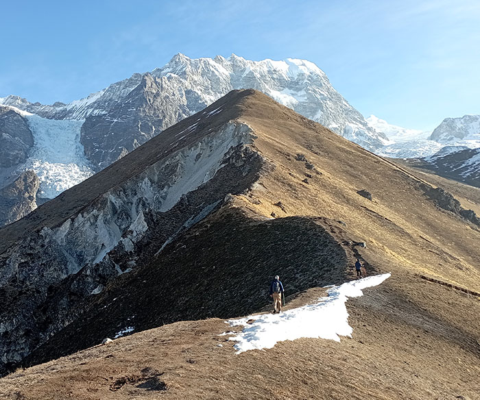
Mount Makalu View from Khongma La Pokhari during the Everest Three Pass Trek.
Which are the Hardest Passes among the Three Passes? The above topics will help and support the trekkers to overcome the hardness and toughness of crossing over the three passes:
The hardest climb from the three passes solely depends on the weather, snow, and the trail condition. The following descriptions describe the treks on each pass, where trekkers can experience the hardness levels among these three passes.
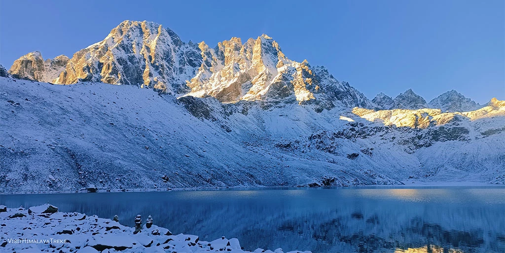
Khongma La Pass 5,545 m/18,192 feet: Distance: 10.61 km or 6.6 miles. Minimum6 hours to Maximum of 9 hours walks.
From Chukung, an early morning start, with a good breakfast and packed lunch, to carry for the long day. The walk follows above Imjatse Valley and is close to the Nuptse and Lhotse mountains.
After a few hours of steady walks, leaving the Imjatse Valley, enter a corridor and a gorge between Nuptse and Pokalde peaks, where Khongma La pass is situated. The walk with a gradual climb over a moraine of rocks and some ice sections to take care of. After a 3-4 hour walk from Chukung, reach the top of Khongma La Pass, marked with a rock cairn and Buddhist prayer flags. Khongma La stands close to Khongma Tse or Mehara Peak 5,896 m/19, 344 feet.
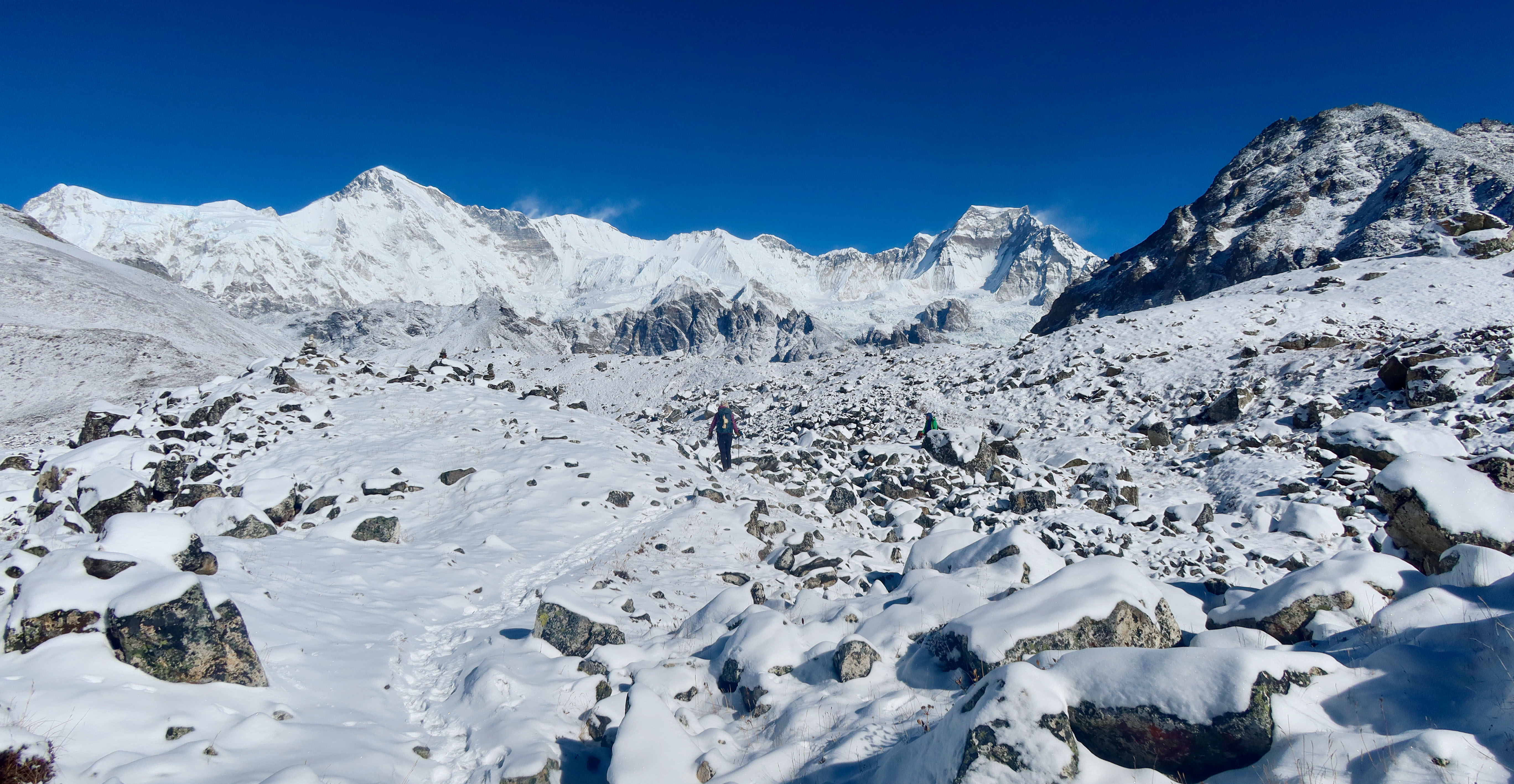
The pass is North of Khongma La Pass, close to the southwest ridge of Nuptse Peak, opposite Lobuche Peak. The descent is tougher than the climb, as the downhill leads to steep over rocks and some ice. Then, the route leads to cross Khumbu Glacier, which can be tricky and technical sometimes due to the movement of glaciers. After walking with care and precaution and then reaching the west end of the glacier, the climb leads to a rocky moraine dune.
From the high ridge, a short descent to Lobuche for an overnight stop in the comfort of a nice and cozy lodge. Khongma La Pass, although the highest among all the passes, the climb is not that difficult. Except for the steep down towards Khumbu Glacier, it can be tough, as well as walking across the Khumbu Glaciers.
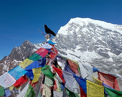
Crossing the Chola Pass from Dzong to Dragnag Gokyo.
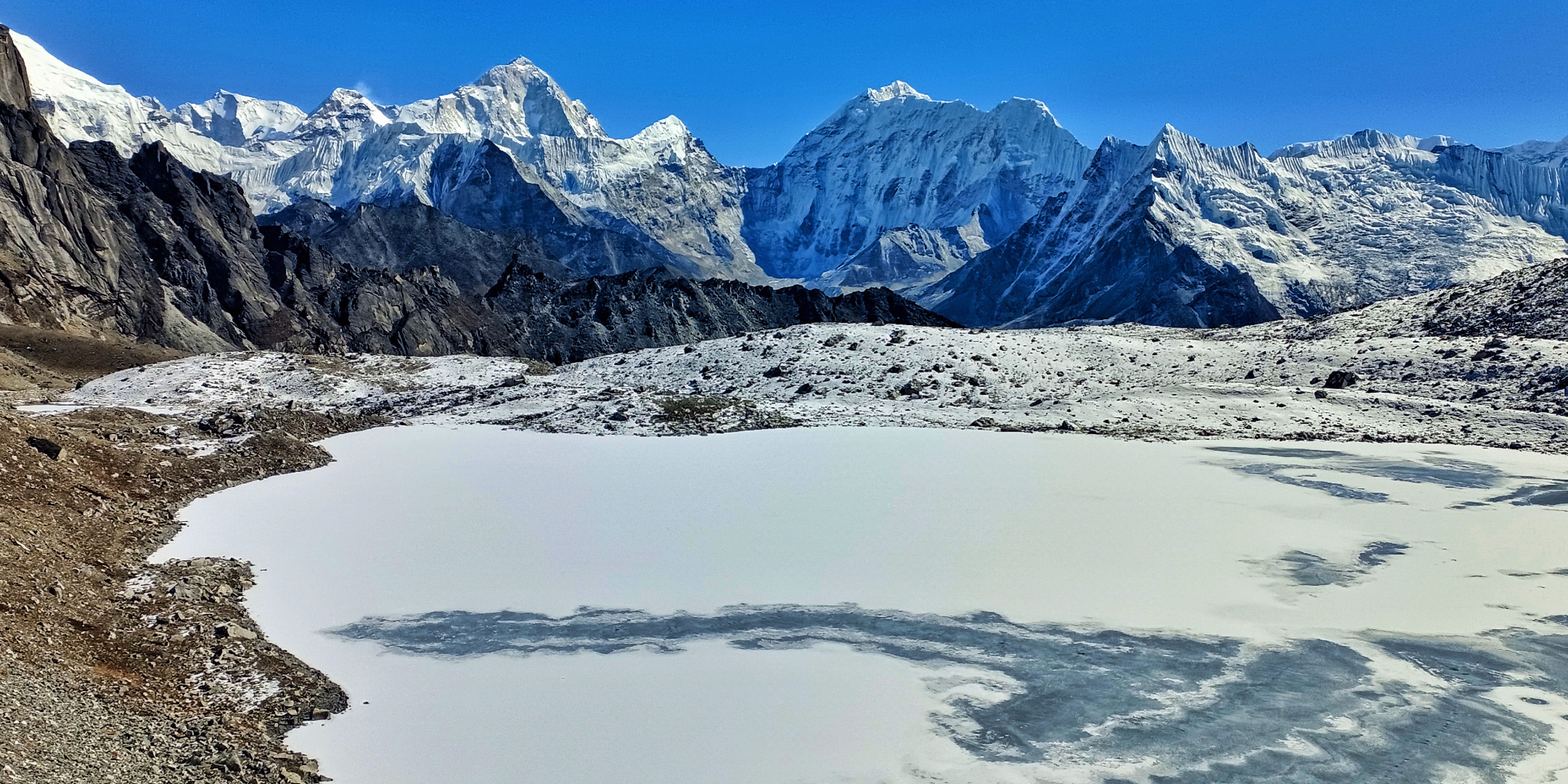
Cho-La Pass: 5,420 m / 17, 782 feet high. From Dzongla to Thagnak. Maximum of 7-8 hrs. Walking distance approx. 8 k.m. / 5 miles.
Climb to Cho La Pass is more than 3-4 hours from Dzongla. Views from the Cho La Pass closest is Cholatse, Nirekha, and Lobuche West / East peaks, the views extend as far as Renjo La Pass and Gokyo Ri View Point. After crossing Khongma La Pass with a visit to the Everest base camp and climbing on top of Kala Patthar. This makes the climbs to Cho La Pass much easier with the altitude after being well acclimatized. The walks from the last lodge at Dzongla lead on a gradual path for a while, then reaching the foot of Cho La Pass.
The climb is not as difficult but the walk leads to a steep ridge, and it is quite strenuous. Where one should take precautions walking on icy paths in a few sections before reaching on top of Cho La Pass. Most trekkers find Cho-La as the hardest of all three passes, but depends upon the weather and fitness level. Nevertheless, after a hard walk to the top of Cho La Pass, the downhill is equally tough with big rock boulders.
It is quite a long descent and steep in some areas to reach Thagnak, a small settlement east of Gokyo Valley. From Cho La Pass, a maximum of 2-3 hours’ steep descent to Thagnak at 4,700 m/15,400 feet. A drop of more than 700 meters from Cho La Pass to Thagnak. It is located at the base of Cho La, around the eastern end of Gokyo Valley, with simple lodges.
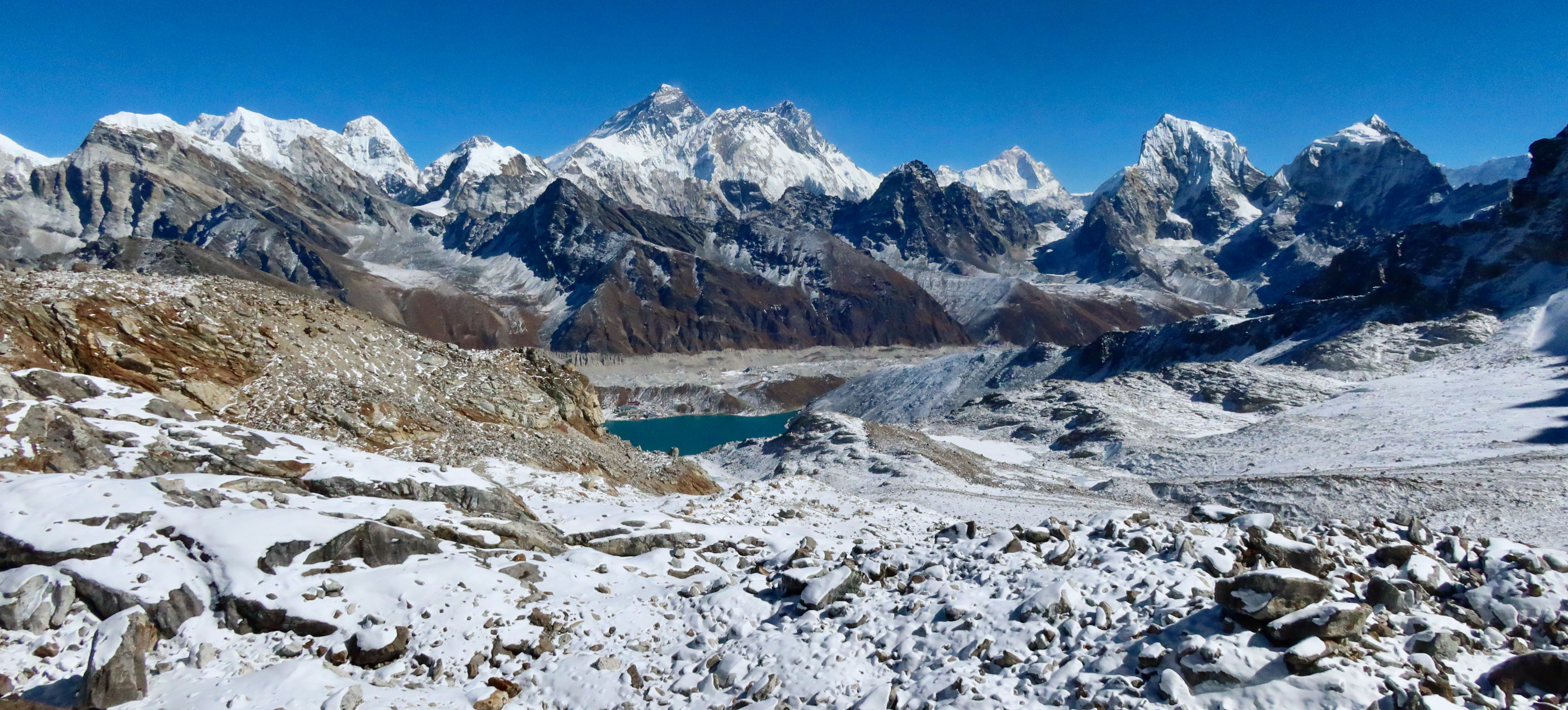
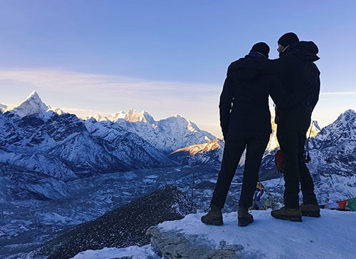
Mount Everest, Lhotse, and Makalu view including Gokyo Lake from Renjo la Pass.
Renjo-La Pass 5,360 m /17, 585 feet, Distance from Gokyo to Lungden / Lumde Approx. 11 km. / 7 miles. Walk from Gokyo to Renjo-La Pass 4.5 km / 2.5 miles.
From Renjo La Pass, enjoy views of Mt. Everest, Lhotse, Nuptse, Makalu, Cho Oyu, and Ama Dablam with Kyajo-Ri and Kongde peak range. The last and final adventure climb to Renjo La, after crossing over Khongma La and Cho La. As well as having time around picturesque Gokyo Valley, where all members will be much stronger after being well acclimatized.
Which makes it easier to take the challenge of climbing the top of Renjo La, of all the passes. Trekkers find Renjo La safe and easy, as it does not involve walking on glaciers. But can encounter a few ice and snow patches during the climb and descent. Renjo La is a scenic pass with grand views of surrounding mountain ranges with the world’s four highest peaks.
From the top of Renjo La, an easy downhill walk to Lungden or Lumde at 4,340 m high. It is close en route to Nepal and Tibet borders, bounded by the high Nangpa La Pass. From Lungden, the trail leads downhill to Thame Village and back to Lukla via Namche Bazaar.
Everest Three High Passes Trek Option, Clockwise or Anticlockwise:
Everest Three High PassesTrek with two alternative options to choose from clockwise or anticlockwise. The clockwise direction leads west end of Khumbu Valley from Thame Village, then heading up to cross Renjo La Gokyo Valley, then cross the high Cho La Pass, EBC, and complete the three high passes with the last Khongma La Pass.
The Clockwise route leads from the northwest to the eastern end of Khumbu Valley, as well as the visit mount Everest base camp. Then climb on top of the Kala Patthar rocky hill, the famous viewpoint. The most preferred route by trekkers is taking the options of anticlockwise, which is quite reasonable. The Himalayan weather pattern is unpredictable sometimes, even in the best seasons of the year.
If the passes get snowed in, trekkers using the clockwise will suffer more than people taking the opposite direction. The reason is that if the weather gets bad and unfavorable with too much snow, the pass may get closed. The trekkers have to re-route the journey by taking the main trail to reach and cross the other two passes to complete.
For people choosing the anticlockwise if the weather closes in, and the first Khongma-La gets snowed. But still, the trekkers can cover other highlight destinations towards Everest base camp and Kala Patthar. Using, the easy route following the main popular trail that does not involve the high passes. After a few days by then the other passes, Cho La Pass and Renjo La Pass will be open as the weather gets fine. The snows on the passes melt after a few days. The option of anticlockwise is more sensible, with a wise decision and this is why trekkers prefer anticlockwise routes.
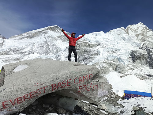
Everest Base Camp 5364 meters.
Don't Skip the Scenic viewpoints on Everest Three High Pass Trekking;
On joining for Everest Three High Passes Treks, en route to designated destinations and overnight stops. Trekkers can enjoy side trips while enjoying rest and having time to explore the scenic high viewpoints. At Dingboche, Gorakshep, Gokyo, and Thame Valley after crossing the last Renjo La Pass.
Nangkar Tshang View Point is 5,616 meters/18, 425 feet high.
On Everest Three High Passes Trekking, reaching Dingboche around Imjatse Valley, located at 4,410 m/14, 468 feet. Most companies' itineraries include rest days in Dingboche, a moderate-sized settlement with many good lodges. At Dingboche on a rest day, enjoy a few hour's hike uphill to a high ridge and viewpoint of Nangkar Tshang View Point. A hike of a few hours winding up above Dingboche and Imjatse Valley offers a spectacular panorama of surrounding mountain ranges.
Close view of Lhotse, Nuptse, and Ama Dablam North Face, with Island Peak towards the east of Imjatse Valley. Include views of Mt. Makalu in the east with Taboche and Cholatse towards the west. The views extend towards the Kangtenga, Tharmasarku, and Kwangde range of peaks. Close to the ridge top is a small monastery located, where Buddhist monks and priests meditate.
Chukung Ri Viewpoint 5,550 meters/18,208 feet. From Dingboche, a few hours of good walks reach you at the close end of Imjatse Valley. A small settlement of Chukung is located at 4,730 m / 15,518 feet, close en route to the Island Peak base camp.Reaching Chukung for lunch and overnight stop from Dingboche. Having time in the afternoon, trekkers can enjoy a few hours of climbing to the top of Chukung Ri View Point.
A rocky ridge top stands atop Chukung settlements, and after having lunch, enjoy a climb to support acclimatization before crossing Khongma La Pass. Views from Chukung Ri View Point is facing a close look at Island Peak, Ama Dablam, Makalu, and Nuptse. Includes Lhotse with Lhotse Shar towards the east with an array of peaks.
Kala Patthar View Point 5545 m / 18,192 feet. After crossing the first pass of the adventures over Khongma-La and then visiting the Everest Base Camp. Spending overnight in Gorakshep at 5,180 m high, the next morning, a few hours of good climb to Kala Patthar hill. A rocky ridge top covered in black boulders of rocks, hence the name Kala Patthar for black rock.
Kala Patthar View Point top is the highest spot of the adventure and offers a sweeping panorama of giant snow mountain ranges. Kala Patthar is a famous and popular viewpoint for trekkers and mountaineers for the closest views of Mount Everest. Kala Patthar's viewpoint is close to the towering peak of Mt. Pumori, facing Everest towards the east at a mere distance. It is truly a mesmerizing view to cherish, one of the highlights of Everest Three High Passes Trekking.
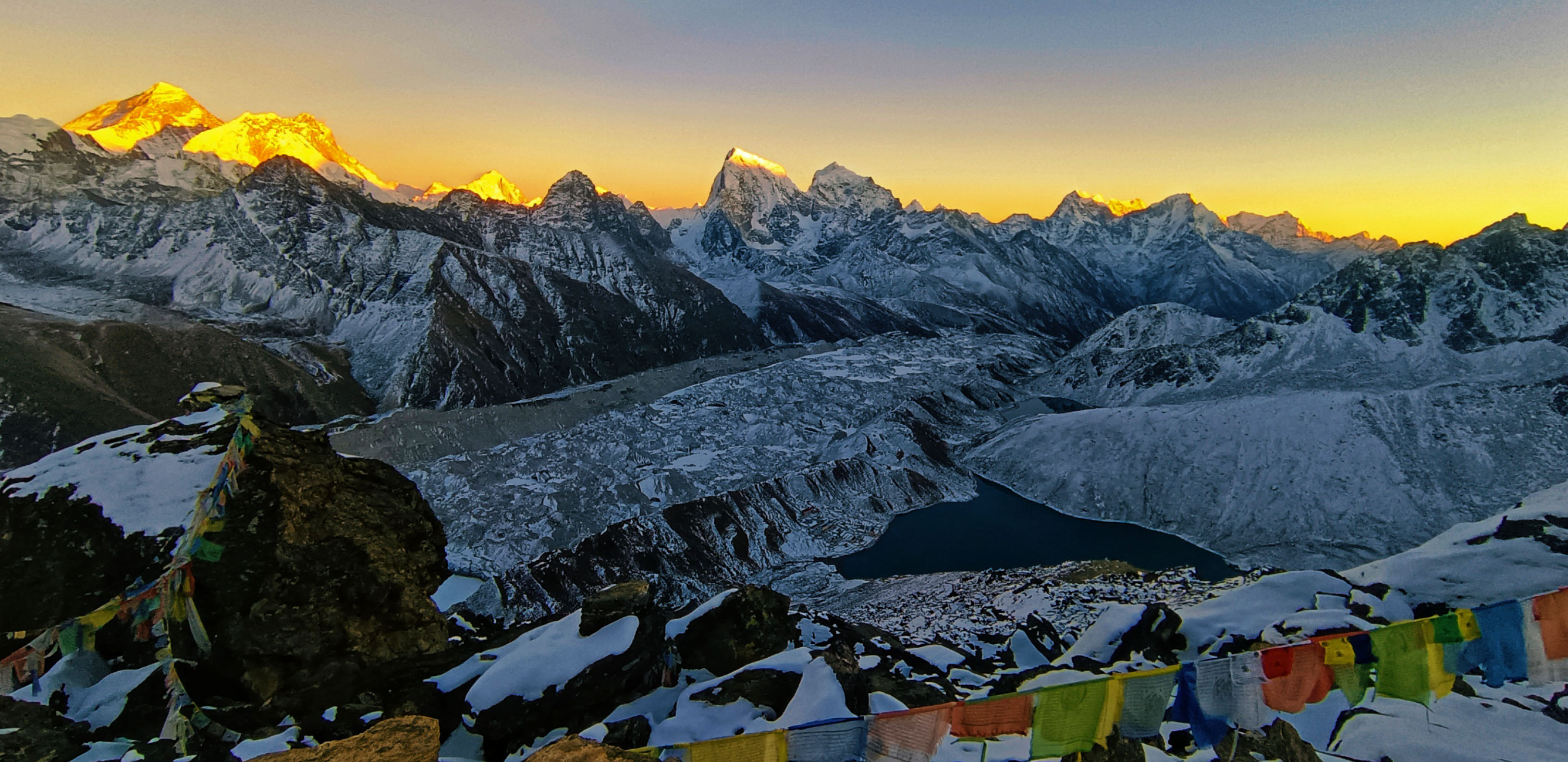
Sunset view over Mount Everest, Lhotse, and Makalu from Gokyo Ri View Point.
Gokyo Ri Viewpoint 5,360 m/17,585 feet. Gokyo Ri Viewpoint and the Gokyo Valley are the center of the two passes of Cho La and Renjo La. Most trekkers have a free day at the Gokyo Valley of Lakes with Ngozumpa, the longest glacier in Nepal. As well as around the Himalayan ranges, the valley of lakes with the last 5th and the 6th lakes. Gokyo Valley is famous for the scenic viewpoint of Gokyo Ri offers a grand view of the world's four highest peaks.
An early morning hike with a steep climb of 2-3 hours to the top of Gokyo-Ri offers spectacular sunrise views and the world's four tallest peaks, Mt. Everest 8,848.86 m, includes 4th world's highest Mt. Lhotse at 8,516 m, and 5th high Mt. Makalu at 8,463 m, with the 6th highest Mt. Cho Oyu at 8,201 m. Include the grand panorama of the Gokyo Valley and its beautiful lakes with Ngozumpa Glacier. The Gokyo Ri view viewpoint is one of the most picturesque viewpoints for a refreshing morning hike from the Gokyo Valley.
Fifth Lake Day hike from Gokyo, Mount Cho Oyu, and Gyachung Kang view from left to right.
Fifth Lake is 4,980 m/16,338 feet with Cho Oyu Base Camp 5,600 m/18,372 ft. In Gokyo, with an extra day for rest and acclimatization, people with interest can enjoy a long hike to Gokyo 5th Lakes and Mount Cho Oyu Base Camp. It is North West, from the Gokyo and beyond, with no lodges or settlements. The walk follows towards sheer wilderness close to Ngozumpa Glacier and past the fourth icy Lake to reach the 5th Lake. Enjoy the dramatic scenery of towering snow-capped peaks that surround the Gokyo Valley.
The 5th Lake is close to Mt. Cho Oyu South Base Camp, it is the world’s 6th highest peak at 8,201m/26,906 feet high. Mt. Cho Oyu forms the borders of Nepal and Tibet, and most mountaineering expeditions prefer climbing from the north sides of Tibet. The route is more accessible to reach the summit than from the Nepal Southside. The 5th Lakes and Cho Oyu Base Camp offer grand views of both the South and North side of Mt. Everest.
Magnificient views of the world’s tallest from the 7,000-meter category peaks of Mt. Gyachung Khang 7,952 m/26,089 feet. The day hike from the Gokyo Valley takes more than 6 hours both ways. The trail is rough to follow, a faint path over a moraine of rocks and ice in a few places. But offer exceptional views of Mt. Everest, the North and South. As well as standing close to Mt. Cho Oyu and Gyachung Khang peaks. Thame Valley and Buddhist Monastery 3,750 m/12,303 feet. Approx. 12. Km /7.5 miles walking distance from Lungden to Thame village.
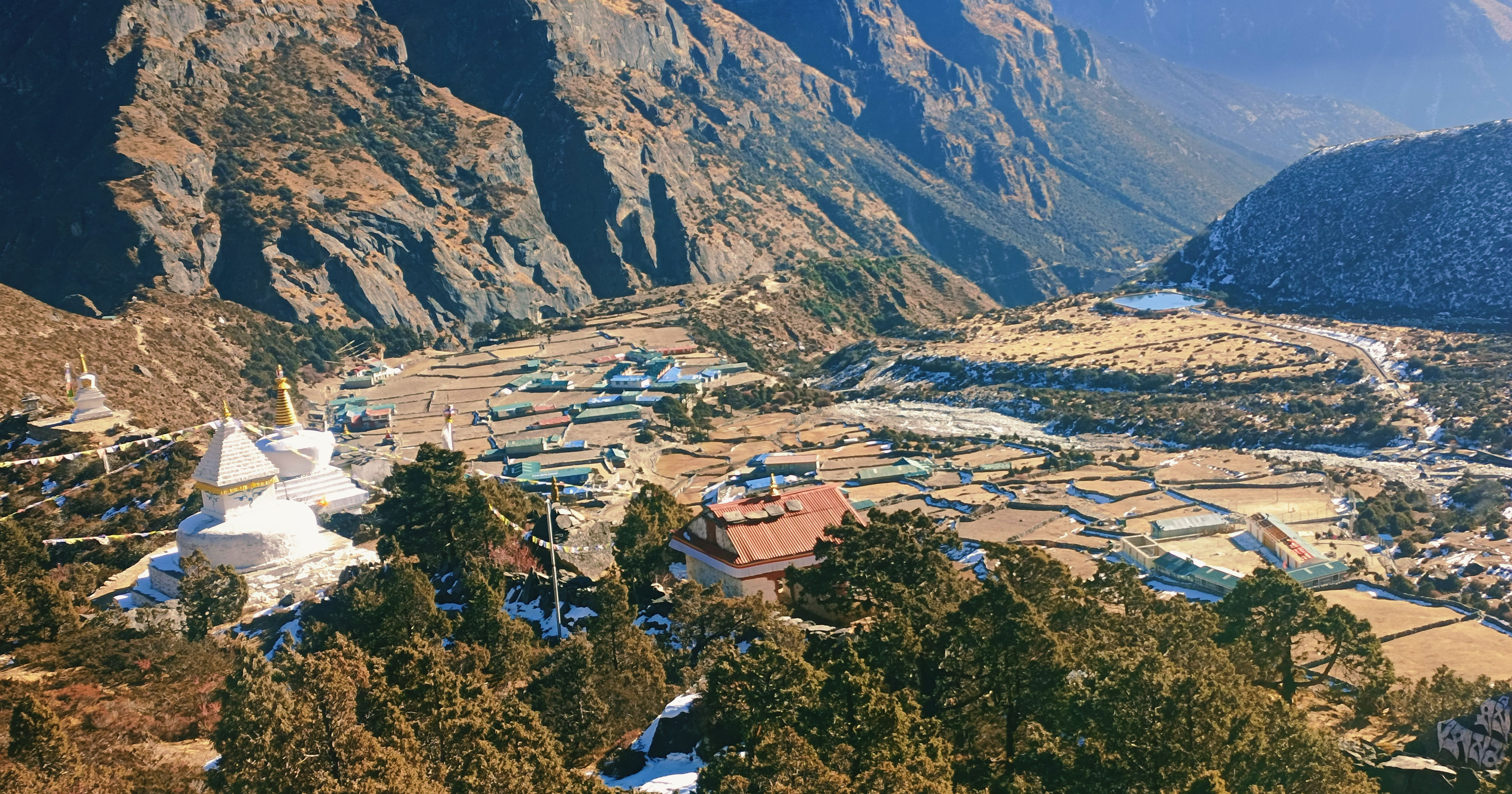
Thame Village is situated around the far west end of the Khumbu area and close to Namche Bazaar, about a 3-4-hour trek. Thame, a moderate-sized village, stands around a windswept valley close to the Kwangde Himal range of peaks. Thame is the vantage village for several routes to Rolwaling Valley via a high Tashi Labtsa La pass. It also falls on the old Trans Himalayan Trade Routes between Tibet and Khumbu, Nepal. Thame is less visited by a mass flow of trekkers, only ventured by trekkers coming or en route to Rolwaling Valley.
As well as en route to Gokyo Valley via Renjo La Pass and Everest Three High Passes Treks. The walking hour from Lungden to Thame is 3-4 hours via Marlung village and crossing Bhote Koshi River, which flows from the Tibet side. Thame is a large scattered village with a monastery of more than 500 years old, perched above the Thame village. Thame monastery celebrates the Mani Rimdu festival like in Tengboche around late spring times end of May, or 1st week of June as per the Buddhist calendar.
Thame Valley Khumbu region of Nepal.
Everest Three High Pass Trek Conclusion:
Everest Three Pass Difficulties can be overcome, making the adventure a wonderful experience. When booking for the best seasons, spring and autumn/fall, when the weather will be at its best. The other good ways to make the trek less difficult are planning, choosing, and making the itinerary flexible. Allowing enough rest days for acclimatization and with average hours of walking at each overnight destination.
The rest is staying physically fit and in sound health with a positive attitude and taking things as they come. Around the Himalayas, like Everest Three High Pass Treks, expect the unexpected sometimes. But taking things as it comes will make the adventure enjoyable on daily walks. Everest Three High Pass Trekking grade is moderate to adventurous, and challenging in snow conditions.