Chulu Far East Peak Climbing

Chulu Far East Peak Climbing

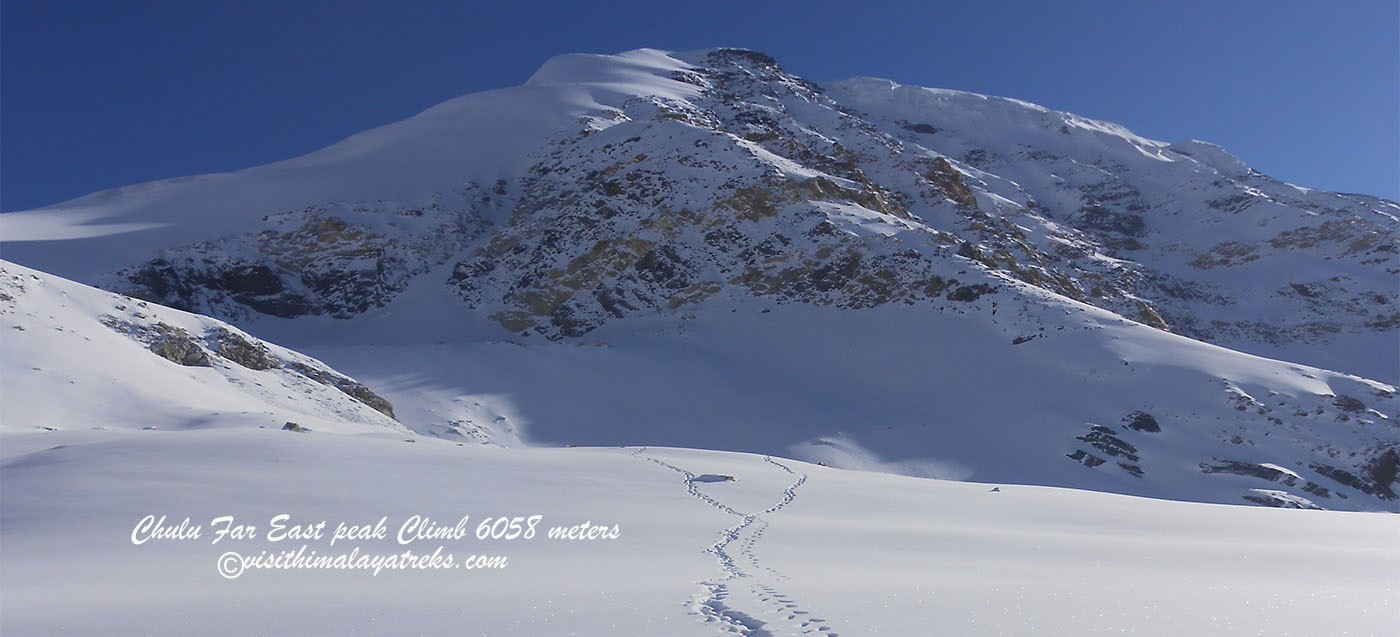
The Chulu Far East Peak climbing trip includes Nar Phu Valley Chulu Far East Peak (6058 meters) and Tilicho Lake trek to hidden villages of Nar and Phu, Chulu Far East Peak, and the world's highest lake; Tilicho Lake. The popular Annapurna Circuit is damaged by the driving road; however, the Nar Phu Chulu Far East Peak Tilicho Lake trek offers a much more spectacular trek in Annapurna Circuit. It visits the hidden villages of Nar and Phu.

Tibetan plateau-styled remote villages located at Upper Manang. It is a pleasurable walk for adventure lovers as all the villages in Nar Phu Valley are rich in Buddhist culture and monasteries, with the views of the massive Annapurna Range always lingering behind. Exploring Nar, Phu, and Khang La Pass (5320 meters) and the exciting trekking peak, Chulu Far East (6058 meters) to the North of the Manang village is the main attraction of the trek.

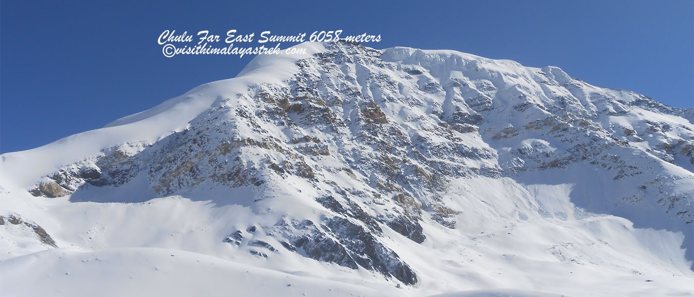
Beyond the Annapurna Range, among a group of peaks known as the Manang Himal, the eminently climbable Chulu Far East (6058 meters) boasts a superb summit panorama that includes all of the Annapurnas, as well as a host of little-known peaks in Tibet. Nar Phu Chulu Far East Peak Tilicho Lake Trek also goes to Tilicho Lake (4949 meters), right at the bottom of Tilicho Peak (7134 meters). This unrelenting adventure also crosses Mesokanto Pass (5089 meters) which offers 360-degree views which include Tilicho Lake, Nilgiris, and the Dhaulagiri Range.

Most of the trekking is done away from the main trail and passes through the interesting medieval villages of Nar, Phu, and Ngawal. All these villages look ancient and are very different from other villages on the trail. If someone seeks more then, side trips to Milarepa Cave and Ice Lake, can provide an interesting religious insight into the region. Similar to the classic Annapurna Circuit trek, varying landscapes, vegetations, climate, and rich culture are the major highlights of Nar Phu Chulu far East Peak Tilicho Lake Trek.

Chulu Far East Peak Climbing itinerary,
Day 01: Arrive in Kathmandu (1335 meters).
Day 02: Sightseeing and Trek Preparation.
Day 03: Drive to Dharapani (1960 meters).
Day 04: Trek to Koto (2600 meters).
Day 05: Trek to Dharmasala (3220 meters).
Day 06: Trek to Chaku (3772 meters).
Day 07: Trek to Phu (4050 meters).
Day 08: Acclimatization Day at Phu.
Day 09: Trek to Nar (4150 meters).
Day 10: Trek to Khang La Phedi (4530 meters).
Day 11: Cross Khang La (5280 meters) and trek to Ngawal (3670 meters).
Day 12: Trek to Chulu Far East Base Camp (4835 meters).
Day 13: Trek to Chulu Far East High Camp (5334 meters).
Day 14: Summit Chulu Far East (6058 meters) and return to Base Camp.
Day 15: Extra Day.
Day 16: Trek to Manang (3540 meters).
Day 17: Trek to Tilicho Base Camp (3734 meters).
Day 18: Trek to Tilicho Lake (4949 meters).
Day 19: Cross Tilicho Pass and trek to Yak Kharka (3510 meters).
Day 20: Trek to Jomsom (2720 meters).
Day 21: Fly to Pokhara.
Day 22: Sightseeing at Pokhara and flying back to Kathmandu.
Day 23: Free day at Kathmandu.
Day 24: Departure.

Chulu Far East Peak Climbing Detail Itinerary

DAY
  • 1

    A representative from Visit Himalaya Treks with the company’s display board will greet you outside the arrival terminal and transfer you to your Hotel. The trek leader will meet the group for a meeting and provide a detailed briefing on the trek. All the required information regarding the trek would be provided. (Overnight at Hotel)

    Altitude 1335 m
    Meals Breakfast
    Accommodation Hotel
  • 2

    A full day guided tour to several of historical and spiritual attractions enlisted under the World Heritage Sites. The trek leader will meet the group for a meeting and provide a detailed briefing on the trek. All the required information regarding the trek would be provided. 

    Altitude 1335 m
    Meals Breakfast
    Accommodation Hotel
  • 3

    After breakfast we drive to Dharapani. It is a long driving day across country on the Prithivi Highway towards Pokhara and turning north from Dumre along the Marshingdi Valley far as far as Dharapani. (11-12 hour drive) 

    Altitude 1960 m
    Meals Breakfast, Lunch, Dinner
    Accommodation Tea House / Lodge
  • 4

    The trek starts on the secondary road and does so for the most part of trek until the trek reaches Manang. The road passes the villages of Bagarchap and Danaque. The trail gets briefly off the road and starts to climb through the woods to Temang. Stunning view of Manaslu (8163 meters) opens up at Temang. The trek returns back to the road and goes through the small villages of Thanchok and then finally reaches Koto. (6 hours) (Overnight at Camp)

    Altitude 2600 m
    Meals Breakfast, Lunch, Dinner
    Accommodation Camp
  • 5

    The trail leaves the road, enters a narrow valley, leaving crowded settlements behind, and heads for sparsely inhabited Nar Phu Valley. The trek crosses and leaves Marshyangdi River and starts to follow Phu River gradually climbing into the valley. The valley gets narrower and goes through pristine forests, as the valley grows slightly wider with views starting to open up. The trail actually goes underneath a waterfall right before ending the day at Dharmasala. (6-7 hours) (Overnight at Camp)

    Altitude 3220 m
    Meals Breakfast, Lunch, Dinner
    Accommodation Camp
  • 6

    Trek to Chaku is an interesting day as the trek enters into a different kind of landscape. The day starts with a steep climb that passes the village of Meta. The terrain is leveled all the way up to Junam. After Junam a ridge has to be climbed and another has to be traversed. From the second ridge the village of Chaku can be seen. It is all downhill from the second ridge to Chaku. (6 hours) (Overnight at Camp)

    Altitude 3772 m
    Meals Breakfast, Lunch, Dinner
    Accommodation Camp
  • 7

    A steep drop kicks off the day and leads to the river. The trail stays on the riverbed for a while and then slowly starts to climb off the river. The climb ends another long day at Phu. (6-7 hours) (Overnight at Camp)

    Altitude 4050 m
    Meals Breakfast, Lunch, Dinner
    Accommodation Camp
  • 8

    A short hike up to the monastery offers stunning views of the valley. Although a long and exhausting walk to Himlung Base Camp also remains a good alternative. (Overnight at Camp)

    Altitude 4050 m
    Meals Breakfast, Lunch, Dinner
    Accommodation Camp
  • 9

    The trek retraces back to Chaku and passes the village. The loose steep downhill trail with rubbles goes down to a bridge over a narrow and deep gorge, After the river, the trail once again starts to climb and does so for the rest of the day. This is also one of the longer days of the trek. (7-8 hours) (Overnight at Camp)

    Altitude 4150 m
    Meals Breakfast, Lunch, Dinner
    Accommodation Camp
  • 10

    The day is a shorter one as the trek enters the higher elevations. Couple of hours climb ends the day at Khang La Phedi. A good rest is recommended as the trek now enters higher elevations. (3 hours) (Overnight at Camp)

    Altitude 4530 m
    Meals Breakfast, Lunch, Dinner
    Accommodation Camp
  • 11

    An early start to the day to cross the Khang La. The day starts with a climb that continues to get steeper and only ends at the top of the pass. A steep drop in a rocky moraine then on a scree leads to a new valley. Steep drop continues throughout the day and finally ends at the village of Ngawal. This is one of the longest and hardest days of the trek. (7-8 hours) (Overnight at Camp)

    Altitude 5320 m
    Meals Breakfast, Lunch, Dinner
    Accommodation Camp
  • 12

    After a long hard day, the trek to the Base Camp is another long day. The trek heads to a new valley and starts to climb and gains around 100 meters in altitude. After passing a scenic and towering waterfall, we finally reach the base camp.(6 hours) (Overnight at Camp)

    Altitude 4835 m
    Meals Breakfast, Lunch, Dinner
    Accommodation Camp
  • 13

    Now the trek heads higher towards the high camp, following a steep ascent towards a col. In around 5 hours, we finally climb the ridge and reach the high camp. (5 hours) (Overnight at camp)

    Altitude 5334 m
    Meals Breakfast, Lunch, Dinner
    Accommodation Camp
  • 14

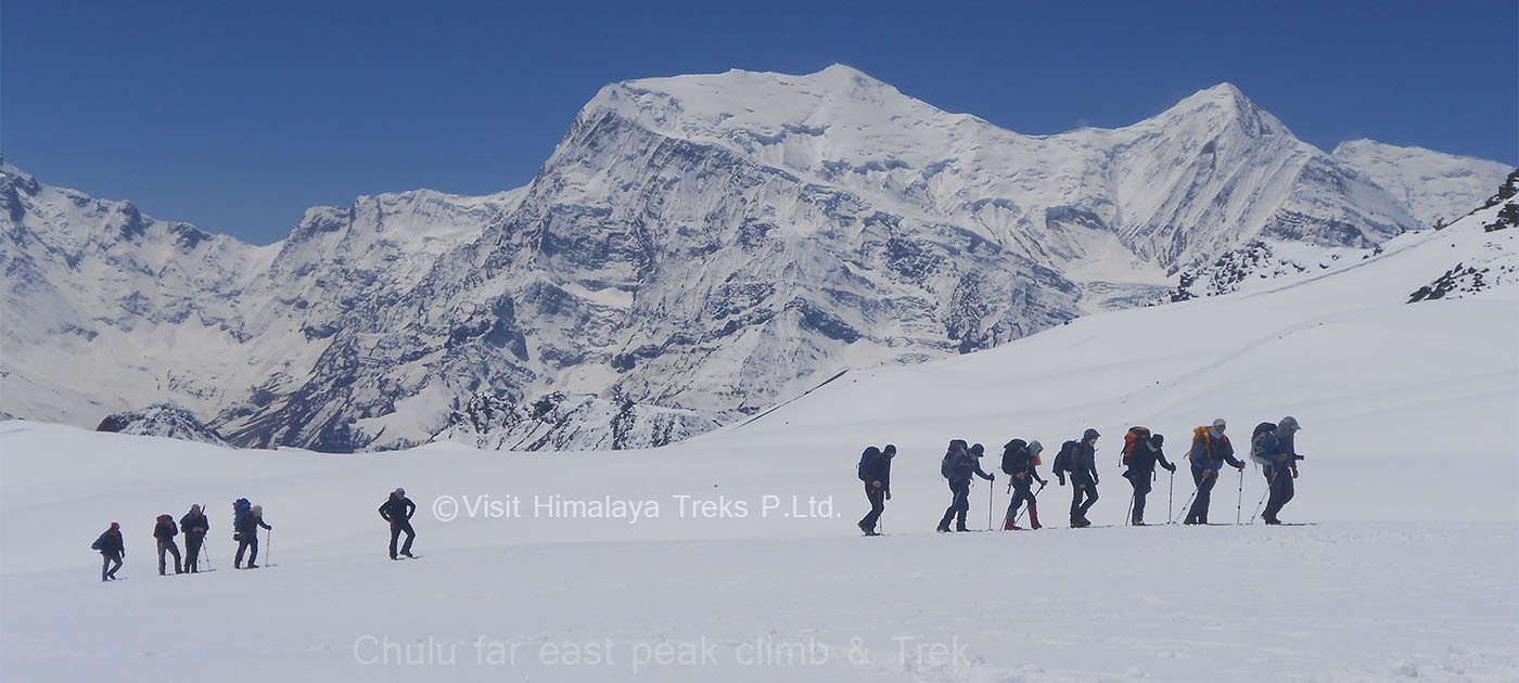
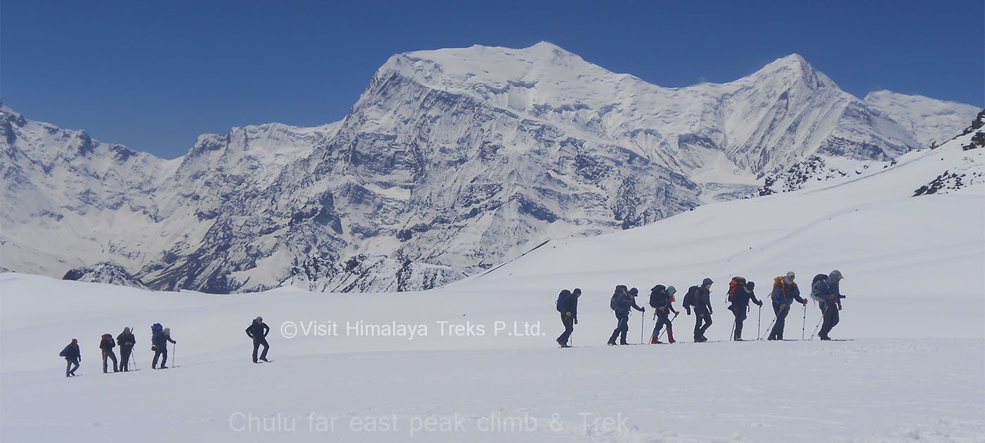
    The push for the summit starts very early in the morning, mostly it starts before or around 3 a.m. in the morning. The climbing guide will fix all the safety lines wherever necessary and will be close taking care of you. A steep and frequent long ascent on the 40 - 45 degrees slope finally ends at the top. After a short stay at the top to enjoy the panorama of mountains and then we head back to Base Camp.(9-10 hours) (Overnight at Camp)

    Altitude 6058 m
    Meals Breakfast, Lunch, Dinner
    Accommodation Camp
  • 15

    This spare day can be used in case of bad weather on the day of the summit attempt. This day can also be used as an extra day for acclimatization.

    Altitude 5334 m
    Meals Breakfast, Lunch, Dinner
    Accommodation Camp
  • 16

    A descend down to the valley and an easy terrain joins the trail back with the road near Mugje. After passing through Mugje, the road leads to the village of Braga. Braga has two contrasting parts, an ancient looking village with a monastery a few minutes away from the road and new modern facilitated teahouses at the other side of the road. An easy walk on the road and a final brief climb ends the day at Manang. The road also ends at Manang and the trek will only get back on road after the Thorang La. (4 hours) (Overnight at Camp)

    Altitude 3540 m
    Meals Breakfast, Lunch, Dinner
    Accommodation Camp
  • 17

    The trail now separates from the regular Annapurna Circuit and heads into a different valley. A descent leads into the river and turns into an ascent for the next few hours until Khangsar. After the Khangsar the trail gets narrower and crosses through a scree in the latter part of the day. A flat grassy area with a small stream finally leads to the Tilicho Base Camp. (6-7 hours) (Overnight at Camp)

    Altitude 4150 m
    Meals Breakfast, Lunch, Dinner
    Accommodation Camp
  • 18

    The day starts with a steep climb and then turns into an easier ascent. More majestic views of mountains start to appear in every direction as the trek slowly and continuously keep on climbing. Gangapurna (7455 meters), Annapurna III (7555 meters) and several unnamed peaks starts to show themselves as the climb continues. After a steep section, the lake finally starts to appear as the terrain slowly starts to turn easy. Tilicho Lake is highest lake in the world located at an altitude of 4949 meters.After a brief walk away from the lake we camp on a rocky moraine. (5 hours) (Overnight at Camp)

    Altitude 4949 m
    Meals Breakfast, Lunch, Dinner
    Accommodation Camp
  • 19

    Another early start to the day starts with a steep climb on a ridge. The top of this ridge is marked by a small chorten and after this the trail now drops briefly and a long steady walk follows. After less than an hour, the trail sharply drops and once again climbs back to a second ridge. Now the trail is on an angled slope slowly starts to becomes really rocky. Once again the trail drops and then for the final time it starts to slowly climb to Mesokanto Pass, which is right beside a tall coned shape rock. Now the trail steeply drops and crosses several ridges on its way to yak Kharka. This is the other long day of the trek and almost as difficult as the day of crossing of Tilicho Pass. (8-9 hours) (Overnight at Camp)

    Altitude 5340 m
    Meals Breakfast, Lunch, Dinner
    Accommodation Camp
  • 20

    The trek still continues to drops and continuously loses the altitude. After a long downhill, the trail gets to get easier at Thini and slowly and easily reaches the busy town of Jomsom. Jomsom is also the admintrative headquarter of Mustang, the forbidden Kingdom. Jomsom is also famous for apples and is also known as the apple capital of the country. The apple and apricot brandy from the region is also very popular. A visit to Marpha Village is also an interesting option for the afternoon.(5 hours) (Overnight at Camp)

    Altitude 2720 m
    Meals Breakfast, Lunch, Dinner
    Accommodation Tea House / Lodge
  • 21

    An early scenic flight to Pokhara. Views of Annapurna range and the dominating figure of Machapuchare (also known as Fishtail) (6993 meters) dominates both the sky and the beautiful Phewa Lake with its reflection in it. Afternoon can be enjoyed by the lake as the hotel is located near to the lake. (Overnight at Hotel. 

    Altitude 822 m
    Meals Breakfast
    Accommodation Hotel
  • 22

    A half day guided tour to the most popular and historical sites of Pokhara and a late afternoon flight back to Kathmandu. 

    Altitude 1335 m
    Meals Breakfast
    Accommodation Hotel
  • 23

    A half day guided tour to several of historical and spiritual attractions enlisted under the World Heritage Sites. 

    Altitude 1335 m
    Meals Breakfast
    Accommodation Hotel
  • 24

    A representative from Visit Himalaya Treks Pvt. Ltd. will check your flight tickets and transfer you to the airport before two hours from your flight with a hope of seeing you again in the future. 

    Altitude 1335 m
    Meals Breakfast
    Accommodation No

Cost Includes

    • Arrivals and departure transport by car (We will collect you from the Kathmandu international airport) and transfer to Hotel.
    • A full day sightseeing in Kathmandu with a city guide and necessary transport.
    • 6 nights accommodation (2 persons per room) in Kathmandu and Pokhara in a 3* standard Hotel with breakfast.
    • Pokhara - Kathmandu airfare including airport taxes. 
    • Kathmandu - Besisahar land transportation in a private car. Other sections will be on a local bus.
    • A porter to carry your luggage on treks (Per person 20-kilogram luggage).
    • National Park entry fee and Trekkers Information Management System (TIMS).
    • Group First Aid Kit.
    • All meals and hot drinks during the trek.
    • Peak climbing permits.
    • Group climbing gears like rope, snowbars, and icescrews.
    • Salary, insurance, food, and accommodation for guides and porters.
    • Government Taxes & Service charges.

Cost Excludes

    • Nepal entry Visa Fee.
    • Personal Travel Insurance (Compulsory).
    • Lunch and dinner in Kathmandu and Pokhara.
    • Personal expenses like beverages (mineral water, alcohol, soft drinks), telephone bills, laundry, bar bills, personal tips, etc.
    • Personal climbing gear.

Cost & Date

Start Dates are your arrival date in Nepal and End Dates are the returning date from Nepal.

The set departure dates listed are specially quoted and specified for group joining option. Let us know if the set departure dates are not suitable for you- another dates which are suitable for you can certainly be added by us.

Upcoming Trip Departure

  • Guaranteed - Trip is Guaranteed to run
  • Available - Trip is available to run if minimum group size is filled
  • Limited - Only few space available
  • Booking Closed - Maximum group size is filled

Check Available Dates

Trip Start Date Trip End Date Price Status Book

Reviews ( 0 Reviews For This Package )

Group Size Price
2 - 5 People $3600
6 + People $3300
$ 3600 / Person
BOOK NOW
24 Days Nepal
TRIP OVERVIEW
Chulu Far East Peak Climbing
Altitude 6058 m
Chulu Far East Peak Climbing
Region Annapurna Region
Chulu Far East Peak Climbing
Difficulty Extreme
Chulu Far East Peak Climbing
Group size 2+ Peoples
Chulu Far East Peak Climbing
Best Season October - November in Autumn season and April - May in Spring season.
TALK TO AN EXPERT +977-9851136788

QUICK INQUIRY